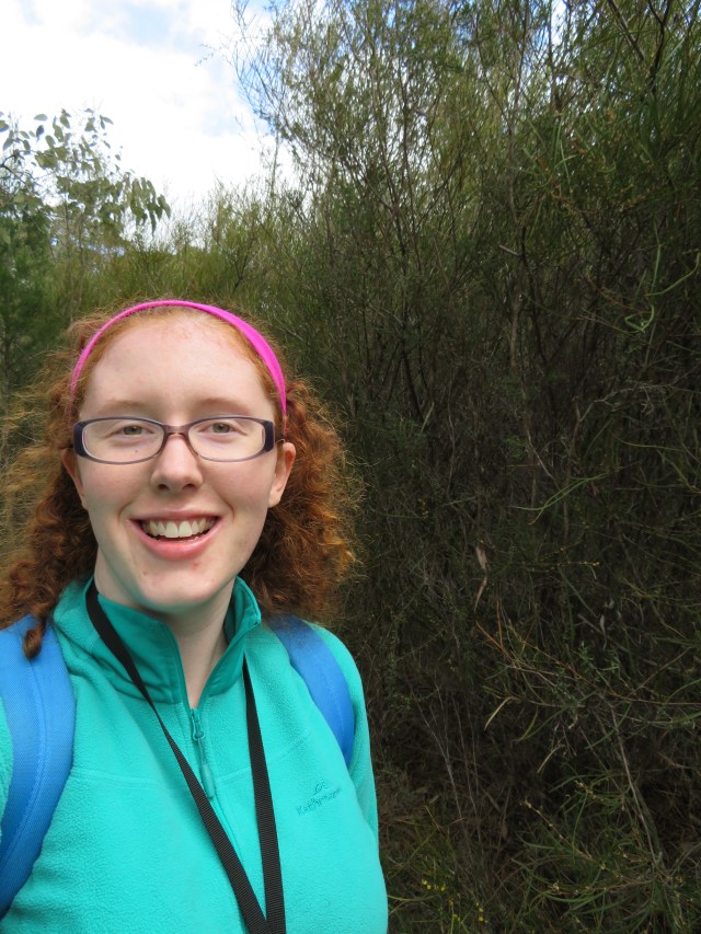
Because I only saw a small part of the park with Mum and Dad on Sunday (or maybe because I think my legs have done me wrong and need to be punished) I went back to Girraween today to do some serious walking. The kind of walking that needs waterbottles, a backpack and lunch.
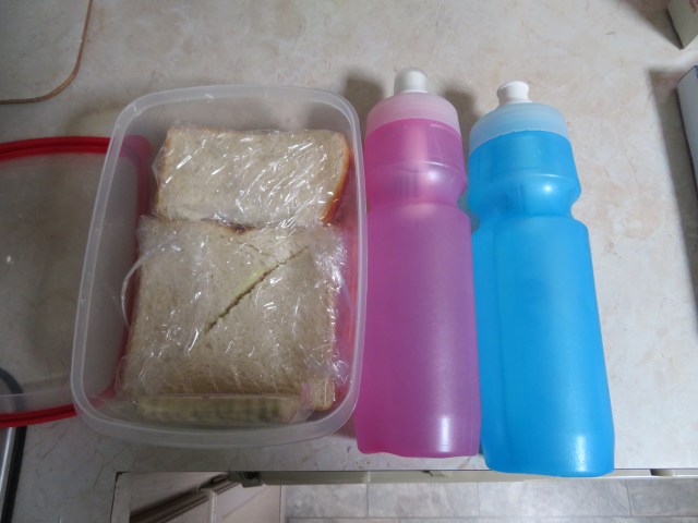
My supplies, rather reminiscent of a packed lunch for school. The large sandwich is ham, cheese and mustard pickles, the half sandwich just has lemon butter on it, and I brought a yoghurt bar as well, just in case.
The information centre was open today, so I swung by to check it out. I learned the The Pyramid is an example of an inselberg – extreme weathering creating rounded summits with steep sides and mainly bare surfaces.


Have some info about Girraween. If you can’t read it, click on the picture – it should enlarge.
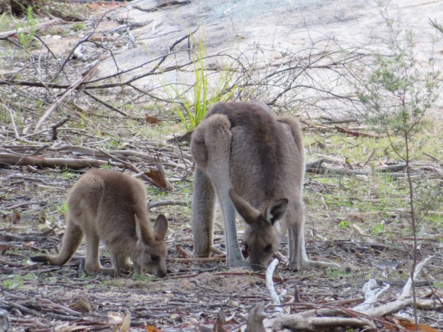
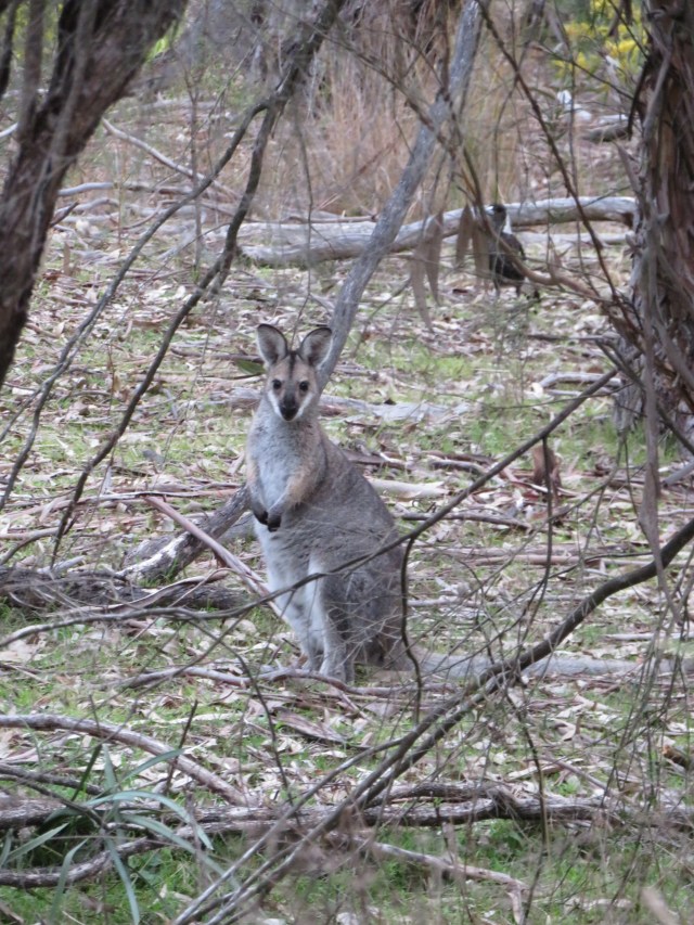
These two were right near the car park, and seemed pretty relaxed about having people so close to them.
I took some photos of the info on the walks, so when I refer to them by name you might actually know what I’m talking about.


The first one I did was the Wyberba walk, just a quick wander near the creek. It basically runs right along the day centre, just putting you a bit into the bush. I’m glad I did it though – look what I spotted! A male Superb Fairy-wren.


I took several pictures in very quick succession. Isn’t he gorgeous? Couldn’t get a really good angle on him though – he just kept jumping around. So I decided to film him for a bit instead.
I think this might be the secret to getting good images of these little, darting birds. No pictures – film them! I got one of his little ladies as well.

Spotted this Currawong lurking in the trees as I came back to the info centre.
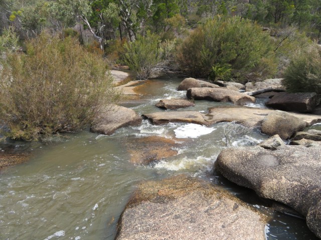
Next up were the more serious walks – The Junction, followed by the Bald Rock Creek Circuit. Now I’m a big fan of interesting landscapes, so get ready for a lot of photos of trees, bush and granite in all kinds of combinations. My usual posts won’t be nearly this image (and video) heavy, but expect a drain on the data allowance whenever I hit up a national park. Landscapes and animals – two things I can never resist immortalising in digital media!


There must have been fire through here at some point – see how the trees look furry? They’re putting out new leaves all over their body, because something’s happened to stress them. Judging by the way some of the trees are blackened, I’m saying fire.


I told you there would be landscapes!
I went through a bit of a marshy area. Listen to the frogs!
Up until this point, the Junction and the Creek Circuit had been following the same path, but now they diverged.
The circuit looped back this way.

But I was heading on this way. I’d come back to the circuit later.


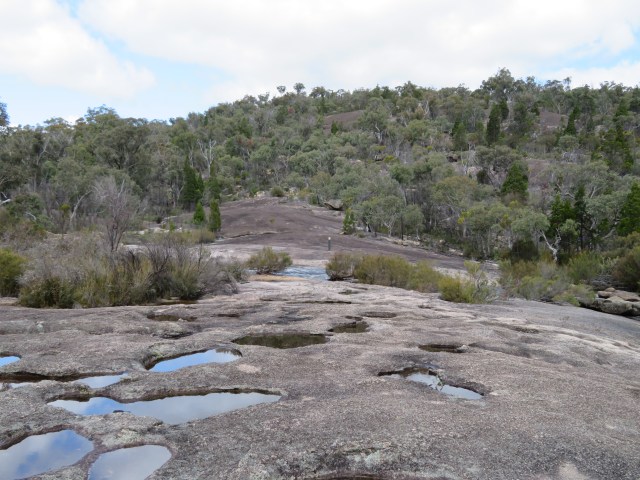
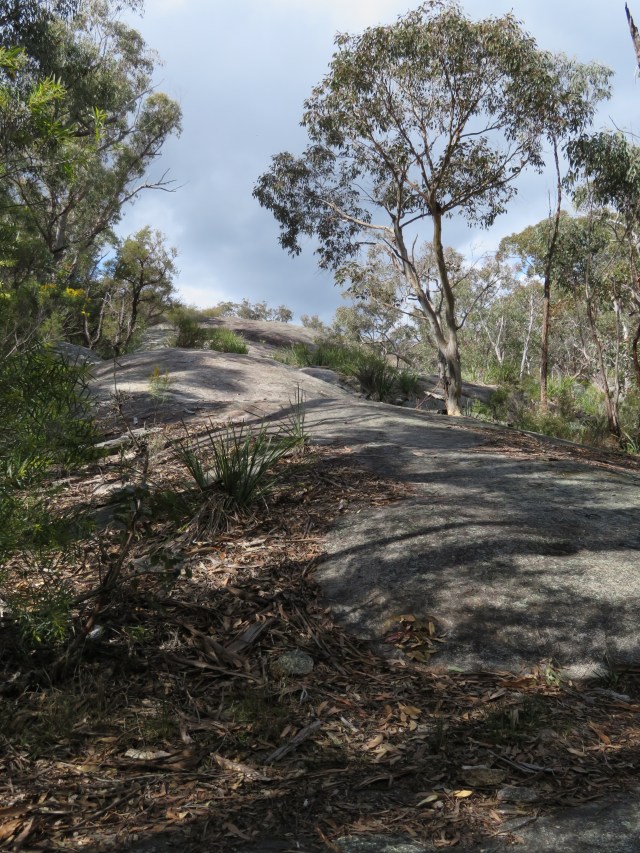
And the landscapes again. Just showing you guys the kind of environment I was walking through. It started out very similar to what I’d seen with Mum and Dad, but then it got scrubby – at times the scrub was higher than my head!
See!
This place was also full of flowers, and the whole place was thick with bees. I got a film of some of them.
I was following the creek for the most part, waiting to come to the junction that I’d been promised. And eventually, I reached it.
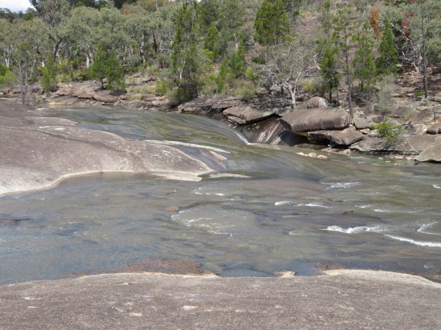
Here it is! The point at which Ramsay Creek and Bald Rock Creek unite! Bald Rock Creek is the one closest to the camera.
The paths of water had created some interesting effects on the river banks, making them look almost tiger-striped.


Stripes of white paint mark the path when you have to go over bare rock. And they come in handy, let me tell you – I wouldn’t have pegged this as the way back without it. No surprise there, though, because it’s so narrow you can’t stand with your two feet together on it.
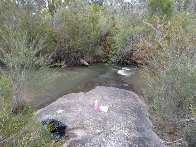
I was getting kinda hungry by now, so I stopped here on the return trek for lunch. I ate my main sandwich, had a nice drink of water, and continued on.


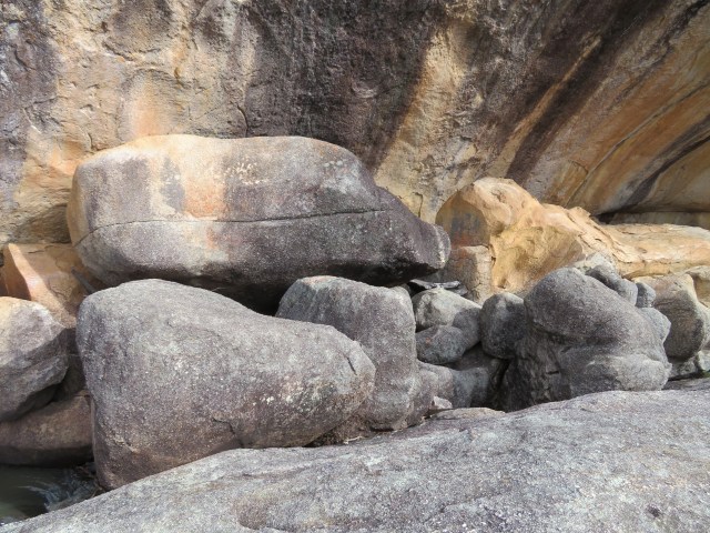
The landscapes strike again! I’m also including what’s called a drill hole – when water eddies, the swirling sand drills into the granite, gradually creating these kinds of holes. This one was much deeper than any others I’d seen.
Joining up with the Bald Rock Creek Circuit, this was where I crossed the creek. It wasn’t as bad as it looks though – the stones were dry and close together, so a few quick hops took me across easily.


The circuit trail.
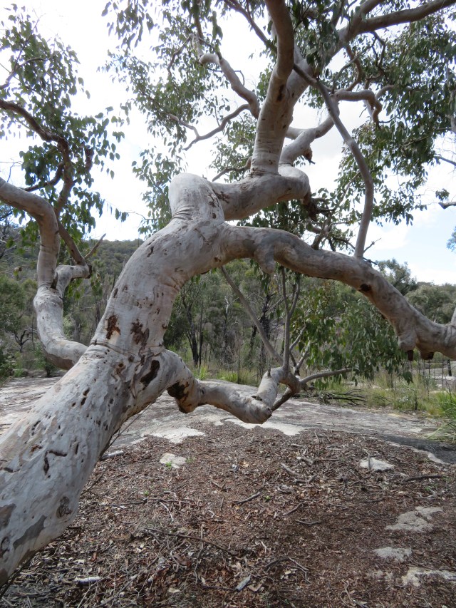
A weird tree I found. It kind of looks like it’s having a seizure.
I came back to the info centre almost right after that weird-looking tree. I had no idea I was so close – I seemed to be out in the bush, then I turned a corner on the path and saw the car park.
I got a good view of Pyramid from the info centre, though.
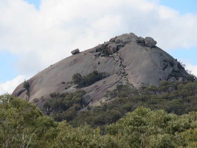
You see that broken line of rocks marching up the face? That was right below where the three of us were trying to walk up on Sunday – what were we thinking?
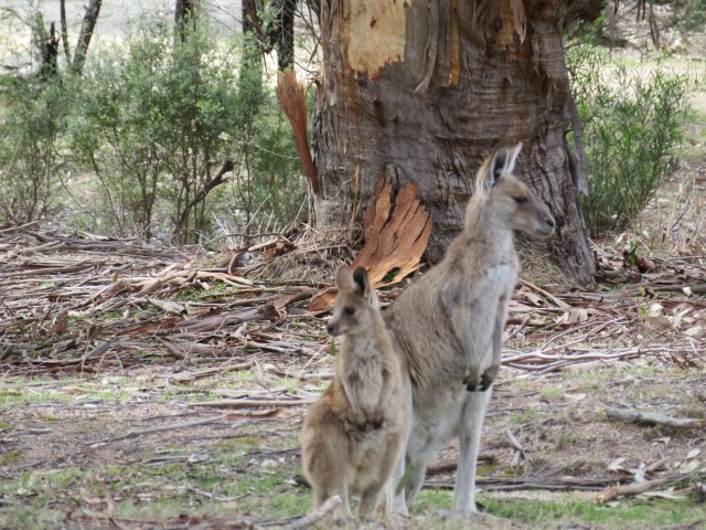
The kangaroo and joey were still around – must be good eatings at the visitor centre.
My next two walks were Dr Roberts Waterhole and the Underground Creek. Have some photos of the signs about them:


As you can see from the map, they didn’t start from near the visitor’s centre, so I followed a partially-sealed road up into the mountains. It had a lot of twists and turns, and I had to adjust my ears as I went higher and higher. Eventually, I came to a dirt car park with a sign indicating that this was the place.
I did Underground Creek first, and it was a very different environment to the one I’d just left. I guess it was the higher altitude, but you can see the vegetation is different.


There seemed to be much more birdlife here as well. Or maybe they were just more vocal because it was later in the day, I’m not sure. Frogs are joining in the second video, which was taken a little further down the path.


There was heaps of banksia! The green stuff? Banksia. Those brown spots? Banksia. The path? Banksia! Well, no, that was dirt, but everything else was banksia!
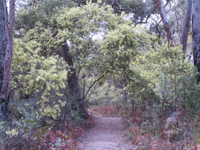
An arch of wattle I encountered along the path.
We got back to the granite eventually. This was off the path, but I just had to go for a scramble. It was a pretty easy one too – I didn’t even need to use my hands! It didn’t earn me much of a view though, just trees and rocks all around.


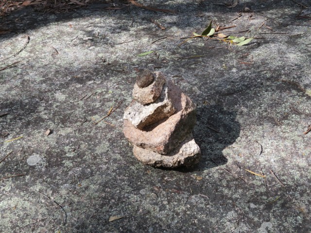
There was this little stack of rocks at the base. First Donnelly’s Castle, now here? Is this some kind of rural pastime I’m not aware of? Haldane, Angus, Aunty Sandy, I’m asking you; is this a ‘thing’ in the country?
A little further along the trail, I thought I heard a car. At first I figured it was some ranger doing a patrol, and I must be near a service road. Nope, it was actually the sound of rushing water – the underground river was just around the corner!


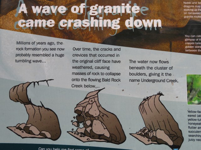
I take photos of these signs so I don’t have to type out the explanation.
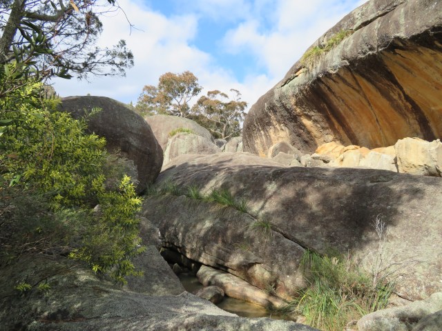
I figured I could get a better view from that flat, slightly-sloping rock. And I was right.
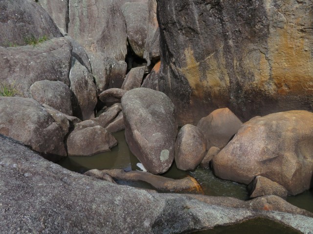
You can just see where the creek comes from – in the darkness between those boulders, you can see the white of the rushing water.
Then it vanishes underneath rock.
On the way back, I passed a small creek bend when I heard the flutter of wings. I managed to catch these little critters in a little tangle of branches over the water.
This is a White-throated Honeyeater. It isn’t in focus at the beginning but give it a few seconds.
A male White-browed Scrubwren (females aren’t as dark near the eyes). He’s not really in focus, but you get to see (and hear) him sing for a little bit.
I had just started down the path to the waterhole when I spotted a New Holland Honeyeater drinking nectar from a banksia. Look at the beautiful blue tint to the feathers around the face and chest.


The water hole. It’s called Dr Roberts Waterhole after Dr Spencer Roberts, a medical practitioner in Stanthorpe in the 1930s, and the one who first appealed to the government to create the national park. He wanted to protect the habitat of the superb lyrebird and the common wombat.
I was hungry again when I got here, so I ate my lemon butter sandwich while sitting on the very edge of the waterhole.
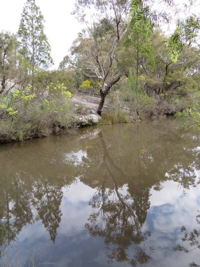
This is a photo I took purely for the reflections on the water.
Then it was time to turn back. There were some birds flitting around the car park when I got back, so I took some videos. This is the only good one, of a Yellow Thornbill, just hopping around in the leaf litter.
I stopped again at the info centre on the way out – I wanted to do the short Wyberba walk again before I left. Most people were gone by now, since it was getting on for 5pm, I thought I might see some more animals. Boy, was I glad I did that!
There was a Willie Wagtail fluttering around the day use area. It’s funny, when you see them up close, the little white markings above their eyes look like angry eyebrows.
You can see the camera’s much shakier now – it was getting quite cold, and my fingers were starting to numb up.
This is some form of Thornbill. It’s hard to tell, but I think it’s the Brown Thornbill.
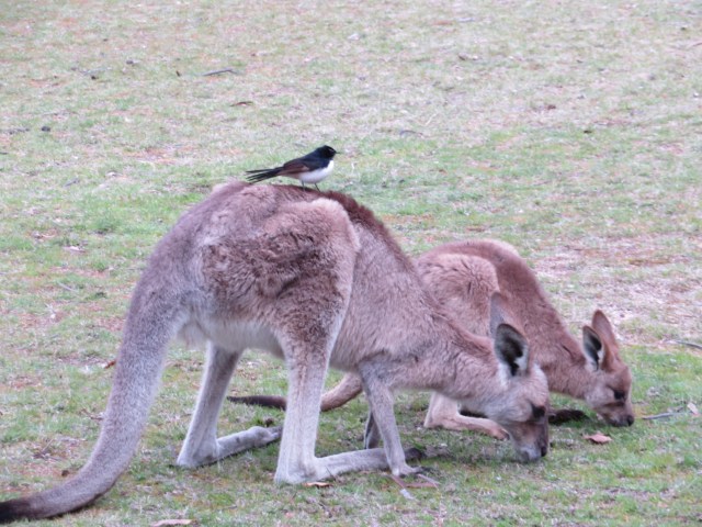
Yes, the willie wagtail is on the kangaroo’s back. I just had to get a photo of it.
And yes, this does seem to be the same kangaroo and joey that were there all day. It obviously works for them, and they’re sticking with it.
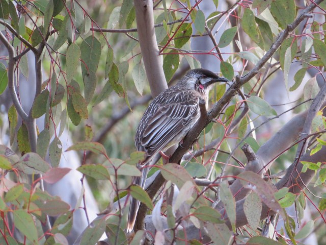
The Red Wattlebird.
Red-necked Wallaby (and a magpie lurking in the background).
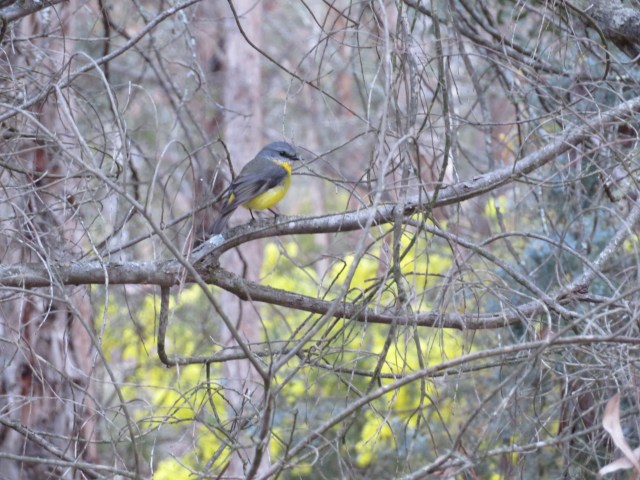
I resorted to video to get most of the small birds because they were always moving so quickly. But this Eastern Yellow Robin was the perfect model, and held still beautifully for me.

“That’s a funny-looking Rosella,” I hear you say. I, too, am puzzled by it – the patterns of green are similar to the Eastern Rosella, but it doesn’t have the yellow chest and wings. So I honestly have no idea what it is, but its buddy is the regular Crimson Rosella.
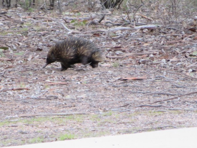
And what do I spot as I’m heading to the car? An echidna, trundling across the path and off into the trees. I whipped my camera out and snapped a quick photo.
I like the word ‘trundle’. It really describes the way echidnas seem to move.
The sun was starting to set, so it was time to head back to Turtle Shell for a nice hot shower. At the caravan park, showers cost 20c for 6 minutes of hot water, but I felt all my long hours of walking had earned an indulgence, so I splurged for 12 minutes. It was very restorative.
Then it was time for dinner and, of course, for writing this post. It was also time to consult the Girraween website to find out the names of the birds, because I didn’t know any of them. Except the Willie Wagtail.
And now it’s very late, because all these images and videos took a while to upload. Time to go to bed – good night!

Lovely photos and a great read … almost as good as being there xXx
LikeLike
Thanks, Aunty Margaret! I’m particularly pleased I got all those little birds.
LikeLike
Hi Jenny !
Great to read your blog ! The little stone stacks I have only been vaguely aware of , but apparently they are a bit of a craze in wilderness areas , maybe a bit like graffiti . Saying ” I was here “. Unfortunately they are becoming a problem because there are so many of them worldwide ( well at least in the U.S.) , that they are beginning to disturb the natural environment. A few stone stacks are used to mark trails in the bush , but mostly they are for no reason at all.
Love the pics and am excited that you are enjoying bushwalking !!
Love Aunty Sandy xxx
LikeLike
Huh, I did not know that – today I learned something!
LikeLike
Fabulous to see! Just like David Attenborough!
LikeLike
Thanks! I felt very chuffed to get those little birds.
LikeLike